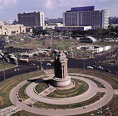
 The city of Cairo covers an area of more than 453 sq km (more than 175 sq mi), though it is difficult to separate the city from some of its immediate suburbs.
Bracketed by the desert to the east, south, and west and bounded by the fertile Nile delta to the north, Cairo sits astride the river, though it spreads farther on the east bank than the west.
Cairo also includes several river islands, which play an important role in the life of the city.
As the region's principal commercial, administrative, and tourist center, Cairo contains many cultural institutions, business establishments, governmental offices, universities, and hotels, which together create a dense pattern of constant activity. ( Tahrir Square )
The center of downtown Cairo is Tahrīr Square, located on the east bank.
A hub of tourist activity, the vast, open square contains numerous attractions, including the Egyptian Museum, the Arab League headquarters, and the modern Umar Makram Mosque.
Extending from north to south along the east bank is Al Kūrnīsh (the Corniche), Cairo's main thoroughfare.
( Garden City )
Located nearby is the narrow strip of land known as Garden City, one of the city's newer residential areas.
( Zamalik )
In the center of the city is the river island of Zamālik (also called Jazīrah, meaning “the Island”), which contains the upscale residential and commercial neighborhood also known as Zamālik, the Cairo Opera House (founded in 1869), and the Cairo Tower (1957).
Three bridges link the island with both banks of the river. The island of Al Rawdah, located to the south, is linked to the mainland by two additional bridges, while another bridge to the north carries road and rail traffic across the Nile.
Also outside the city's central area on the east bank, spanning from the northeast to the southeast, are the neighborhoods of Islamic Cairo. These neighborhoods are known for their narrow streets, crowded suqs (bazaars), and hundreds of mosques, many dating back to the medieval period.
South of the Islamic district is Old Cairo, where some of the city's oldest architectural monuments can be found. Old Cairo is the home of Cairo's Coptic Christian community, and the site of the Coptic Museum and a number of Coptic churches.
The irrigation of Cairo's desert periphery has allowed for the development of suburbs, such as Heliopolis, located to the northeast.
Other modern suburbs are interspersed with recently created migrant neighborhoods that accommodate the city's growing population.
Industrial areas further crowd the city, restricting its growth. Cairo is served by an international airport, situated approximately 24 km (about 15 mi) northeast of the city; the Ramses train station and a bus terminal are located near Tahrīr Square in downtown Cairo.

0 comments:
Post a Comment