Today the borough of Mitte again forms the heart of the unified city.
Following the administrative reform of 2001, Mitte was enlarged to include the former central boroughs of Wedding and Tiergarten.
Other important central areas include Kreuzberg and Friedrichshain, now united as the Friedrichshain-Kreuzberg borough, and Prenzlauer Berg, now incorporated as a part of the Pankow borough.
 ( Tiergarten )
Tiergarten contains a large wooded park, a zoo, and a variety of public monuments as well as the large, modern Congress Hall and the Reichstag building, which was built from 1884 to 1894.
The Reichstag and the surrounding area have undergone renovation to accommodate the Bundestag (the lower house of Germany’s parliament) and new offices of the federal government.  ( The Kulturforum Complex )
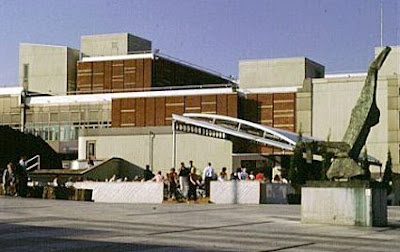
Near Tiergarten is the Kulturforum complex, including the Museum of Applied Arts, and the Bauhaus Archives and Museum, which documents the modernist Bauhaus school of architecture and design that flourished from 1919 to 1933.
A museum complex lines the south edge of Tiergarten.
West of the city center, in the contemporary borough of Charlottenburg-Wilmersdorf, is the Kurfürstendamm, a boulevard that became the commercial center of West Berlin after the end of World War II.
The ruined tower of the Kaiser Wilhelm Memorial Church, which was built in the 1890s and destroyed in World War II, stands at the east end of the Kurfürstendamm.
The memorial serves as a reminder of the devastation of war.
Near Kurfürstendamm is Tauentzienstrasse, a prominent shopping area and site of the Europa Center, which houses a 22-story complex of restaurants, shops, offices, and cinemas.
Kreuzberg, now a part of the Friedrichshain-Kreuzberg borough, located directly south of the Mitte, is a residential area known for its large Turkish immigrant community and its concentration of younger residents.
To the west of Kreuzberg and south of Tiergarten is Schöneberg, a largely middle-class residential neighborhood. This neighborhood is now part of the Tempelhof-Schöneberg borough. ( The Oranienburger Strasse )
A half-mile north of the Unter den Linden is the Oranienburger Strasse, the heart of prewar Berlin’s Jewish district. Revitalization of the area includes the restoration of the New Synagogue, built in 1866.
Gangs of Nazis badly damaged the synagogue on November 9, 1938, when they organized a night of anti-Jewish rioting known as Kristallnacht (German for “Night of Broken Glass”). 
( The Synagogue )
The synagogue is now a center for the study and preservation of Jewish culture. Berlin’s oldest Jewish cemetery is nearby.
To the east of the city center, the Friedrichshain neighborhood contains largely residential sections in its northern portion.
One of Friedrichshain’s major streets, Karl-Marx-Allee, is lined by an imposing series of high-rise residential buildings constructed during the 1950s in an ornate monumental style of architecture popular in the USSR.
The southern part of Friedrichshain contains storage yards for manufactured goods and industrial products.
At the edge of Friedrichshain, next to the city center along the eastern bank of the Spree, is Alexanderplatz, a large square with restaurants and stores.
Prior to unification, Alexanderplatz was the cultural center of East Berlin. Its most prominent feature is the Fernsehturm, a 365-m (1,198-ft) television tower topped by a popular revolving café.
( The Fernsehturm )
Berlin’s tallest building, the Fernsehturm was built during the 1960s in a futuristic style and has become a popular stopping point for tourists.
Near the square are the Gothic-style Marienkirche (Church of Saint Mary) and the 19th-century red brick Rathaus (city hall).
To the north of the city center lie two working class neighborhoods: Wedding and Prenzlauer Berg.
Wedding is an industrial center, while Prenzlauer Berg, which lies just east of the former Berlin Wall, houses workers as well as a growing community of artists and students.
Even before unification, Prenzlauer Berg was a gathering point for artists and nonconformists dissatisfied with East German politics and society.
Bullet holes from the war still scar the walls of the district’s aging tenement buildings, many of which are in a state of disrepair and neglect.
In the west and southwestern portions of the city, the landscape becomes more open, with grasslands, parks, and lakes dominating the scenery.
Major natural features in this region include the extensive Grunewald forest and the Havel lakes, whose shores include a kilometer-long stretch of sandy beach.  ( The Grunewald Forest )
The Grunewald forest, which covers 32 sq km (12 sq mi) in southwestern Berlin, is a major recreational area for Berliners seeking relief from the crowded central city.
North of the Grunewald are the residential neighborhoods of Charlottenberg and Spandau.
Founded in the 13th century as an independent town, Spandau is best known as the site of a prison that housed Nazi war criminals. Its medieval streets remained relatively undamaged by World War II bombings.

0 comments:
Post a Comment